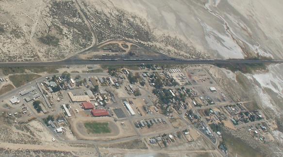
Gerlach

Gerlach is named for Gerlach Land and Livestock Company from the Gerlach and Waltz Ranch, owned by Louis Gerlach. The town was settled in 1906 when the Western Pacific Railroad was built. The Gerlach Post Office was created on October 9, 1909.
Gerlach NV is at Highway 447 mile marker 75, and is 103 miles from Reno. Highway 447 was formerly known as Highway 34.
References
- Gerlach, Nevada (Wikipedia)
- Helen S. Carson, "Nevada Place Names," p. 119.
- Map
- Danger Ranger's Gerlach History images
- Pronunciation of the word "Gerlach"
- http://ndep.nv.gov/bffwp/gerlach.htm Nevada Division of Environmental Protection water system upgrade
- http://www.world66.com/northamerica/unitedstates/nevada/gerlach
- Nevada Historical Marker 152: Gerlach
Situated between Black Rock Desert on the east and Smoke Creek Desert on the west, the townsite of Gerlach lies in country long occupied by prehistoric man. John C. Frémont traveled through Northern Paiute Indian lands when he camped here in 1843 and named "Boiling Springs" 1/4 mile north of town. This was also emigrant country; the Noble Road left the Applegate-Lassen Trail at Black Rock Springs, went past this site and southward through Smoke Creek Desert toward Susanville. The town was established when the Western Pacific Railroad was constructed in Nevada 1905-1909. It still functions as a railroad division headquarters.
Gerlach—A town on the Western Pacific Railway, 125 miles northeast of Reno, 438 miles northeast of San Francisco, 483 miles west of Salt Lake City, 94 miles west of Winnemucca, Nev. ; railroad division point. Stages from this town to Eaglesville, Cedarville, Bidwell-Modoc Co., California. Population, 500. Has express, Western Union telegraph, hotels, several stores, school house. Shipping point for many towns north and west.
Resources
See Also
- Gerlach "Great Boiling" Springs
- World War II The experiences of Roy Nishiguchi's family in Gerlach during the war.