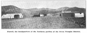
Farrell
Farrell is the site of a former town located 25 miles northwest of Lovelock and seven miles from Vernon.[1]
Farrell is located in the Farrell Mining District, which is north east of the Seven Troughs Mining District.
Carlson states that Farrell was named either for William F. (Bill) Farrell or Jack Farrell (mine owner)[1]
Carlson states that Farrell had a post office from July 20, 1907 until September 30, 1911, when Mazuma became the post office[1].

References
- ↑ 1.0 1.1 1.2 Helen S. Carlson, "Nevada Place Names: A Geographical Dictionary," p. 112. Named for William F. (Bill) Farrell, Reno Evening Gazette, June 3, 1907 and Lovelock Tribune, July 19 and 26, 1907.
- GNIS
- Alternative Name: Farrel, Citation: "'Nevada': National Map Company, Indianapolis, Indiana, no date (map states it uses data from the 1920 census, and the acquisition data by the Nevada Historical Society was 1923). Full color map showing railroads, mountains, roads, communities, and springs, at scale of 1 inch=11 miles."
- Alternative Name: Ferrell, Citation: "Clason's Map of Nevada. Denver: Clason Map Company, 1916, scale 1 in=16 miles."
- Reno Evening Gazette, June 3, 1907. Cited in Carlson, see Forgottennevada.org for text.
- Seven Troughs Miner, April 30, 1910. See Forgottennevada.org for text.
- "The Mining Investor," Volumes 50-51, p. 226, 1908. Photos of the Kindergarten mine, Seven Troughs and Mazuma.
- | Farrell, Forgottennevada.org.