Trego
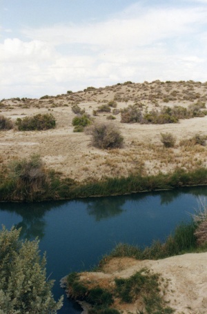
One of many hot springs modified by heavy machinery which line the edges of the Black Rock desert the Trego Trench, as it is commonly known, has wild variations in temperature, with little consistency.
It is on public land part of the Black Rock Desert-High Rock Canyon National Conservation Area, right next to the railroad right of way and crossing.
Crossing the playa at Trego can present a hazard as it is hard to see oncoming train traffic.
Camping is at permitted at designated sites. Fire rings are provided.


See Also
External Resources
- GNIS, Trego
- Citation: U.S. Geological Survey. Geographic Names Phase I data compilation (1976-1981). 31-Dec-1981. Primarily from U.S. Geological Survey 1:24,000-scale topographic maps (or 1:25K, Puerto Rico 1:20K) and from U.S. Board on Geographic Names files. In some instances, from 1:62,500 scale or 1:250,000 scale maps.
- Variant: Trego Siding. Citation: Garside, L. J. and Schilling, J. H. 'Thermal Waters of Nevada' Reno: Nevada Bureau of Mines and Geology Bulletin 91, 1979, 163 pp. Describes hot springs and hot water seeps of Nevada with location information and map at 1:1,000,000. p60
- GNIS, Trego Hot Springs
- Citation: U.S. Geological Survey. Geographic Names Post Phase I Map Revisions. Various editions. 01-Jan-2000.
- Variant: Butte Hot Spring. Citation: Garside, L. J. and Schilling, J. H. 'Thermal Waters of Nevada' Reno: Nevada Bureau of Mines and Geology Bulletin 91, 1979, 163 pp. Describes hot springs and hot water seeps of Nevada with location information and map at 1:1,000,000. p60
- The 1881 Gibbs map of California and Nevada indicates that "Boiling Butte" might be another name for Old Razorback Mountain.
- Butte Spring. Citation: Garside, L. J. and Schilling, J. H. 'Thermal Waters of Nevada' Reno: Nevada Bureau of Mines and Geology Bulletin 91, 1979, 163 pp. Describes hot springs and hot water seeps of Nevada with location information and map at 1:1,000,000. p126
- Kyles Hot Springs. Citation: Sacramento Daily Union Newspaper, August 26, 1864. Letters from Nevada Territory (by G.K.G.)
- Note that there is modern day Kyle Hot Spring near Unionville.
- Trego Hot Spring. Citation: Garside, L. J. and Schilling, J. H. 'Thermal Waters of Nevada' Reno: Nevada Bureau of Mines and Geology Bulletin 91, 1979, 163 pp. Describes hot springs and hot water seeps of Nevada with location information and map at 1:1,000,000. p60
- Helen S. Carlson, Nevada Place Names: A Geographical Dictionary," p. 234. The entry for Trego says that Trego is at the foot of Mount Trego. Carlson cites:
- Trego, Robert, "Black Rock Desert Roads," Nevada State Journal, October 23, 1955, p10-11. Low resolution image of Trego Station, Robert Trego states that there were two houses in 1955. Also mentioned are Sulphur and Jungo.
- Regina C. Smith, Peggy McGuckian Jones, John R. Roney, Kathyrn E. Pedrick, "Prehistory and history of the Winnemucca District," BLM, 1984:
17. 26Pell8, Trego Hot Springs
The Nevada State Museum surveyed 86 miles along a proposed Bell Telephone undergound route in 1971. Among the sites found during this survey was 26Pell8, a major occupation site near Trego Hot Spring. Test excavations showed signif- icant depth and cultural features. Nevada Bell funded large-scale excavations by the Nevada State Museum under the field supervision of James Toney in 1972. Some further field work was done in 1973.
The first published report of this site was by Jonathan Davis and Robert Elston (1972) who described its stratigraphy. They interpreted the startigraphy in terms of climatic variables. Sometime before 3300 B.P. a deep lake occupied the playa. The lake receded during a dry interval (possibly the Al ti thermal ) . Between 3300 and 1400 B.P. moister conditions produced an ephemeral lake, and the major occupation of 26Pell8 occurred at this time. Around 1400 B.P. the climate again became drier, then moister again, and, finally, the dry conditions which prevail today were established.
In 1980 Susan Seek completed a comprehensive report on 26Pell8. She listed the radiocarbon dates, which ranged from 3810 B.P. to 1120 B.P. (Valastro, Davis, and Varela 1979), and related them to the climatic and cultural sequence. Cultural features and artifacts from the site were described in her report which also included a number of specialists ' appendices (Clark 1980; Danise 1980; Davis 1980; Rosen 1980; Stearns 1980; and Wright 1980). Seek concludes that 26Pell8 was occupied between 4000 B.P. and 1000 B.P. Plant foods, jackrabbit, and cottontail seemed to be emphasized. The occurrence of semi -permanent structures suggests extended occupation and Seek concludes that 26Pell8 was a summer camp from which people exploited lacustrine resources on the now dry playa.
Collections and Archive Materials
Nevada State Museum
Selected References
Clark, W.H. 1980 Dansie, A. 1980 Davis, J.O. 1977a, 1977b, 1980 Davis, J.O. and R. Elston 1972 Jensen, A. 1975 Seek, S.M. 1980 Stearns, S. 1980 Toney, J. 1971, 1973 Valastro, S., Jr., E.M. Davis, and A.G. Varela 1979 Wright, C. 1980 Rosen, M.D. 1980
- nbmg.unr.edu/geothermal Trego Hot Springs
- google map
- yahoo map
- terraserver
- Nobles Trail (Emigrant Trails West) "Trego Springs - Marker N-4"
- Map of the Western Division of the Fort Kearney South Pass and Honey Lake Road," 1857. Map that shows the location of Trego as "Hot Spr"
Origin of Trego
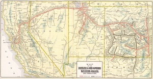
Trego is named after the Western Pacific Railroad siding. But who was Trego?
- A Photo Tour to California Via the Nobles Trail "Trego Hot Springs", "It was night when I saw the springs and therefore could not have a good view of them although I had the sense of feeling and the water one could keep warm [in] comfortably especially if he should be fortunate enough to tumble into the seething cauldron for I could compare it to nothing else..." -- "Mary C. Fish, 1860"
- Nevada Outdoor School, "Trego Hot Springs." While the Nobles Trail was being improved, Trego Hot Springs was discovered. This source says that the springs were once called "Hot Sulphur Springs."
- Devere Helfrich, "Emigrant Trails West: A Guide to Trail Markers Placed by Trails West, Inc. Along the California, Applegate, Lassen, and Nobles' Emigrant Trails in Idaho, Nevada, and California," Arrival at "Hot Sulphur Springs." Description of Trego marker. Description of Frederick W. Lander's improvements.
- Peggy McGuckian Jones, "Emigrant Trails In the Black Rock Desert, Technical Report No. 6," BLM:
- "In 1856 the Nobles' Route was shortened by the discovery of the Hot Springs at Trego. Subsequently, wagon traffic went directly from Rabbit Hole Springs to the Hot Springs at Trego, and across tne desert to Granite Springs, bypassing the long dry stretch between Rabbit Hole and Black Rock Springs entirely."
- "At Trego Hot Springs a large reservoir was built and water in the springs diverted so that it would cool in the process of running to the tank."
- Henry Varnum Poor, "Poor's Manual of Railroads, Volume 53," a transaction involving WPRR: "Albert Trego, Real Estate Agent."
- Dave Basso, "Ghosts of Humboldt region: a glimpse into Pershing County's past," 1970. "Named for a nearby peak". Presumably Old Razorback Mountain, see that page for links about Mount Trego.
Images
- Roy D. Graves Pictorial Collection, Volume 94: Western Pacific Railroad -- Stations and Scenes -- Sacramento Northern :169 Trego station. Western Pacific Railroad. (Description only)
- spench.com
- loupiote
- lukecbarrett
- lukecbarrett