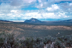
Old Razorback Mountain
Old Razorback Mountain (5495 ft.) is located south of Trego and Frog (Garrett Ranch) Springs.
The GNIS cites the name as "Original township survey plats, published in the 1800's. 1950". The mountain is in Township 33 North, Range 25 East. Unfortunately, the Plats of Nevada State Lands does not include that Township.
The mountain is also known as "Mount Trego", "Trego Mountain", and "Trego Peak" and as "Sleeping Elephant".

External Links
- GNIS, Map
- Pershing County Road Map, 1954. Shows "Old Razorback Mtn."
- Helen S. Carson, Nevada Place Names: A Geographical Dictionary," p. 234. The entry for Trego says that Trego is at the foot of Mount Trego.
- Corpsfuds, Lovelock South Gunnery Range Real Property Report," p. 106. The Pershing County Assessors Map for T 33 N, R 25 E shows "Mt. Trego".