Sand Pass: Difference between revisions
Jump to navigation
Jump to search
Florence Drew was a telegraph operator |
1910 WP Timetable |
||
| Line 8: | Line 8: | ||
[[Bonham Ranch]] is to the north and Flanigan and [[Pyramid Lake]] are to the south. | [[Bonham Ranch]] is to the north and Flanigan and [[Pyramid Lake]] are to the south. | ||
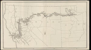
[[Image:Cscrm_000335_07_access3675x2040.jpg|right|thumb|WPRR 1910 Timetable showing Sand Pass]] | |||
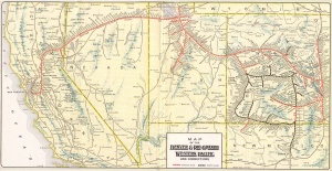
[[Image:1930_D&RGW_WP.jpg|right|thumb|c. 1914 map of the W.P.R.R. showing Sand Pass]] | [[Image:1930_D&RGW_WP.jpg|right|thumb|c. 1914 map of the W.P.R.R. showing Sand Pass]] | ||
Revision as of 06:32, 10 September 2015
Sand Pass is located at the southern end of the Smoke Creek Desert. The Western Pacific Railroad buildings are on the Pyramid Lake Paiute Reservation, so day use permits are required.
Lincoln (1923) states that Fuller's earth was found at Sand Pass, and that the Standard Oil Company prospected the area but found the deposit to not be economical[1].
In 1936, a gravel plant was constructed to provide gravel for maintaining the WP grade[2][3]
Florence Drew was a telegraph operator at Sand Pass and later married Roland Bonham.[4] Bonham Ranch is to the north and Flanigan and Pyramid Lake are to the south.


References
- ↑ Francis Church Lincoln, "Mining Districts and Mineral Resources of Nevada," Verdi, Nev.: Nevada Newsletter Publishing Co., p. 238, 1923.
- ↑ The Deseret News, "Railroad to Renew Grade," March 18, 1936. Description of gravel plant.
- ↑ Theodore D. Overton, "B046: Mineral resources of Douglas, Ormsby, and Washoe Counties," B046, Nevada Bureau of Mines & Geology, 1947. Full version with lower resolution images. Includes images of Fly Geyser, the Petrified Forest, Gerlach Hot Springs, Sand Pass that are in the collection at UNR.
- ↑ Nevada: The Silver State," Vol. 2, p. 859, Western States Historical Publishers, 1970.
External Links
- GNIS
- United States Geological Survey, Bureau of Graphical Names Folder NV_843486_001_Sand Pass_frm_1965.pdf
- Helen S. Carlson, Nevada Place Names: A Geographical Dictionary.
- Post Office established December 11, 1911, discontinued on February 14, 1916, when Sheepshead took over.
- Nevada Public Service Commission, "Reports of the Railroad and Public Service Commissions of Nevada, Volumes 7-8," 1916. Petition by C. R. Bell for a station at Sand Pass. There was an telegraph operator, the complainant wanted a station.
- Reno, Washoe Cty, Nevada 1920-21 City Directory Page 234 "Sandpass. Population 50, A postoffice and station on the W P Ry, 44 miles southwest of Gerlach. Express, American Ry Telegraph, Western Union."
- Nevada. Public Service Commission, "Biennial Report," 1921. Petition requesting a station at Sand Pass. Station created on December 30, 1921.
- Joseph V. Tingley, Jack G. Quade, Larry J. Garside, "OF1990-01: Mineral resource inventory, Bureau of Land Management, Carson," Sand Pass page. Description of mining. Lime was in 1945-46 and again in 1952-66
- University of Nevada, Reno. "UNRS-P1988-55-1089," Photo ca. 1930-1950, Jay A. Carpenter Collection.
- David F. Myrick, "Railroads of Nevada and Eastern California, Volume 3: More on the Northern Roads," p. 113, 2007. Description of the Surprise Valley Railroad mentions Sand Pass.
- John C. Evanoff, "Deep Hole and Sand Pass."
- Civilian Conservation Corps, Sand Pass Well, G-86, photograph of the Gerlach CCC putting in a well at Sand Pass in 1940.