Bronte: Difference between revisions
Jump to navigation
Jump to search
1955 Lovelock 250,000 map showing a section house at Bronte |
|||
| Line 1: | Line 1: | ||
Bronte is a [[Railroad | railroad]] siding between [[Reynard]] and [[Phil]]. | Bronte is a [[Railroad | railroad]] siding between [[Reynard]] and [[Phil]]. | ||
The 1955 Lovelock 250,000 map indicates that a section house was at Bronte.<ref>[http://ngmdb.usgs.gov/img4/ht_icons/Browse/NV/NV_Lovelock_321726_1955_250000.jpg 1955 Lovelock 250,000 map showing a section house at Cholona]</ref> | |||
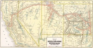
[[Image:1930_D&RGW_WP.jpg|right|thumb|c. 1914 map of the W.P.R.R. showing Bronte.]] | [[Image:1930_D&RGW_WP.jpg|right|thumb|c. 1914 map of the W.P.R.R. showing Bronte.]] | ||
== References == | |||
<references/> | |||
[[Category:Smoke Creek Desert]] | [[Category:Smoke Creek Desert]] | ||
