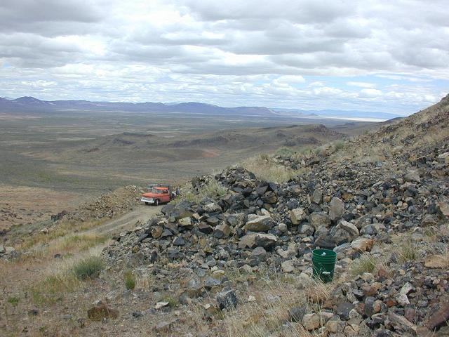
Royal Rainbow Opal Mine: Difference between revisions
Jump to navigation
Jump to search
Use Calico Hills, not Calico Range or Calico Mountains. |
|||
| Line 23: | Line 23: | ||
* Stephen B. Castor, Gregory C. Ferdock, "[http://books.google.com/books?id=flAhr0MbxM8C&pg=PA76&dq=%22royal+rainbow+mine Minerals of Nevada]," Issue 31, p. 76, 2004. The Royal Rainbow Opal Mine is located several km north of the [[Little Joe Mine]]. | * Stephen B. Castor, Gregory C. Ferdock, "[http://books.google.com/books?id=flAhr0MbxM8C&pg=PA76&dq=%22royal+rainbow+mine Minerals of Nevada]," Issue 31, p. 76, 2004. The Royal Rainbow Opal Mine is located several km north of the [[Little Joe Mine]]. | ||
[[Category:Calico | [[Category:Calico Hills]] | ||
[[Category:Mining]] | [[Category:Mining]] | ||
Revision as of 20:07, 1 January 2015
UPDATE Fall 2010: apparently the mine has been closed.

The Royal Rainbow Opal Mine located on private land, 13 miles north of Gerlach Nevada on Highway 34, then 35 miles north on Soldier Meadow road in the Calico Hills.
(Inquire at Bruno's Bar or the Gerlach Museum before heading out)
Accessible by 2wd year-round, but 4x4 is required to drive the ~0.9 miles to the mine site, ~500 feet up.
In 2002, Elselil Philipps ran the mine[1].
References
- ↑ Mark Vanderhoff, "Finding opals in the rough," Reno Gazette-Journal, 11-Sep-2002
Resources
- Early 2000's visit (holeystones.com)
- August 5, 2008 (treasurehunting.today.com, dead link, see archive.org for text)
- August 6, 2008 Photos (treasurehunting.today.com, dead link, see archive.org for text)
- Stephen B. Castor, Gregory C. Ferdock, "Minerals of Nevada," Issue 31, p. 76, 2004. The Royal Rainbow Opal Mine is located several km north of the Little Joe Mine.