Sulphur: Difference between revisions
Jump to navigation
Jump to search
Added <references/> |
Moved 1903 link to the district. |
||
| Line 20: | Line 20: | ||
* [https://en.wikipedia.org/wiki/Sulphur,_Nevada Wikipedia] | * [https://en.wikipedia.org/wiki/Sulphur,_Nevada Wikipedia] | ||
* [http://geonames.usgs.gov/pls/gnispublic/f?p=gnispq:3:::NO::P3_FID:845687 GNIS] | * [http://geonames.usgs.gov/pls/gnispublic/f?p=gnispq:3:::NO::P3_FID:845687 GNIS] | ||
* "[http://www.winnemucca.nv.us/outdoor_recreation_ghost_towns.html Winnemucca County Ghost Towns]," Sulphur was a major shipping and receiving point in the 1920s. | * "[http://www.winnemucca.nv.us/outdoor_recreation_ghost_towns.html Winnemucca County Ghost Towns]," Sulphur was a major shipping and receiving point in the 1920s. | ||
* Trego, Robert, "[http://newspaperarchive.com/us/nevada/reno/nevada-state-journal/1955/10-23/ Black Rock Desert Roads]," Nevada State Journal, October 23, 1955, p10-11. Low resolution image of Sulphur, Robert Trego states that there were three or families living in Sulphur in 1955. Also mentioned are [[Trego]] and [[Jungo]]. | * Trego, Robert, "[http://newspaperarchive.com/us/nevada/reno/nevada-state-journal/1955/10-23/ Black Rock Desert Roads]," Nevada State Journal, October 23, 1955, p10-11. Low resolution image of Sulphur, Robert Trego states that there were three or families living in Sulphur in 1955. Also mentioned are [[Trego]] and [[Jungo]]. | ||
Revision as of 21:14, 26 December 2014
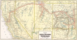
Sulphur is a ghost town located on the Western Pacific Rail Road west of the Kamma Mountains.
Sulphur is named for the sulphur deposits, discovered in 1866.
The mining history of Sulphur may be found in the Sulphur Mining District article.
J. W. Rover was convicted of murdering Isaac Sharp at Sulphur and hung in Reno in 1878.[1][2].


See Also
References
- ↑ Guy Rocha, "Myth #124: True Confessions: The J.W. Rover Case," Nevada State Library and Archives.
- ↑ Mining Magazine: An International Monthly Review of Current Progress in Mining and Metallurgy," p. 416, Volume 8, December 26, 1903.
External Resources
- Wikipedia
- GNIS
- "Winnemucca County Ghost Towns," Sulphur was a major shipping and receiving point in the 1920s.
- Trego, Robert, "Black Rock Desert Roads," Nevada State Journal, October 23, 1955, p10-11. Low resolution image of Sulphur, Robert Trego states that there were three or families living in Sulphur in 1955. Also mentioned are Trego and Jungo.
- Photos 1955 Derailment of the California Zephyr near Sulphur.
- http://nvghosttowns.topcities.com/humboldt/humlst.htm
- Dorthoy Nylen, "The Color of Daffodils, the Smell of Rotten Eggs," Nevada State Museum Newsletter, January/February 2002. Includes image of boiler.
Images
- HU-404, "Nevada Sulphur Smelter," Nevada Historical Society.
- HU-405, "New Mill for Grinding," Nevada Historical Society. Not sure of the location.
- HU-406, "Nevada Sulphur Smelter," Nevada Historical Society.
- HU-417, "Sulphur-Humboldt Co.," Nevada Historical Society.
- HU-418, "Spring Belonging to Sulphur Works," Nevada Historical Society.
- HU-661, "Hotel @ Sulphur in the 1920's," Nevada Historical Society.