Maps: Difference between revisions
Jump to navigation
Jump to search
Remove duplicate text for Keck Historical link |
Link to Humboldt County assessor |
||
| Line 18: | Line 18: | ||
* [http://keck.library.unr.edu/data/drg/drgs.html UNR Keck Library] provides Nevada USGS Topo maps in Digital Raster Graphic (DRG) format | * [http://keck.library.unr.edu/data/drg/drgs.html UNR Keck Library] provides Nevada USGS Topo maps in Digital Raster Graphic (DRG) format | ||
* [http://www.topozone.com/map.asp?lat=40.96911&lon=-118.9397&s=1000&size=l&u=4&datum=nad27&layer=DRG Topozone Black Rock Point East Topo Map] | * [http://www.topozone.com/map.asp?lat=40.96911&lon=-118.9397&s=1000&size=l&u=4&datum=nad27&layer=DRG Topozone Black Rock Point East Topo Map] | ||
=== Assessors === | |||
* [http://www.hcnv.us:1401/cgi-bin/aswmenu Humboldt County Assessor] | |||
* [http://wcgisweb.washoecounty.us/website/map_Warehouse/property_viewer.htm Washoe County property viewer] | |||
Revision as of 05:03, 19 November 2014
Please see the Friends of the Black Rock/High Rock Map page for maps. This page is primarily for links to other sources.
-
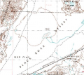 100k Topo
 -
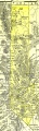 1895 U.S. Atlas - Washoe County
 -
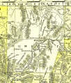 1895 U.S. Atlas - Humboldt County


See Also
External Links
- Friends of the Black Rock/High Rock Map page
- BLM Land Records
- BLM Maps
- Washoe County property viewer
- UNR Keck Library Historic Maps
- UNR Keck Library provides Nevada USGS Topo maps in Digital Raster Graphic (DRG) format
- Topozone Black Rock Point East Topo Map