Calico Hills: Difference between revisions
Jump to navigation
Jump to search
Removed copyvio text. |
No edit summary |
||
| Line 21: | Line 21: | ||
[[Category:Calico Range]] | [[Category:Calico Range]] | ||
[[Category:Mountain | [[Category:Mountain ranges]] | ||
[[Category:Wikipedia articles]] | [[Category:Wikipedia articles]] | ||
Revision as of 04:17, 19 November 2014

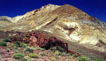
The Calico Mountains are located on the west-north-western edge of the Black Rock Desert Nevada, bounded by Hualapai Valley on the west, Donnelly Peak (in the Donnelly District on the northwest, and the Black Rock Desert playa on the east.
The Calico Mountains & the Calico Complex of Wild Horse Herd Areas are the names used by the BLM to manage the wild horses in this area.
See Also
Resources
- Wikipedia
- nevadawilderness/northwest/calicomtns.htm Calico Mountains Wilderness(nevadawilderness.org, Dead as of 18-Nov-2014)
- Calico Mountains Wilderness (wilderness.net)
- Calico Mountains Wilderness, Nevada (lasr.net)
- view from Steamboat Mountain of eastern side, taken during the Paragon space launch attempt, Sept 14-18, 2003 (Ian Kluft)
- Nevada Atlas of Panoramic Aerial Images, Washoe County, Hualapai Flat - The Calico Range is located in the very center of the image (Full)
- Wild Horses of the Calico Mountains (calicomtns.net)