Historic Maps: Difference between revisions
Jump to navigation
Jump to search
Added links to more maps |
Link at the top to the main website |
||
| Line 1: | Line 1: | ||
This page provides links to historic maps of the area. For modern maps, see http://blackrockdesert.org/maps/. | |||
* 1855 Survey | * 1855 Survey | ||
** [[Humboldt Mountains to the Mud Lakes (1855)]] | ** [[Humboldt Mountains to the Mud Lakes (1855)]] | ||
Revision as of 18:47, 23 November 2012
This page provides links to historic maps of the area. For modern maps, see http://blackrockdesert.org/maps/.
- 1855 Survey
- 1863 DeGroot's map of Nevada (David Rumsey)
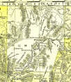
- 1895 U.S. Atlas
- 1896 Post Route Map
- 1918 Map of Lake Lahontan, showing water area and boundary of hydrographic basin from "Fishes of the Lahontan System of Nevada and Northeastern California"
-
1895 U.S. Atlas - Washoe County
-
1895 U.S. Atlas - Humboldt County
See Also
- Maps - Links to modern maps.
