Mountain View Exploration Project: Difference between revisions
Jump to navigation
Jump to search
24k image |
100 k map |
||
| Line 2: | Line 2: | ||
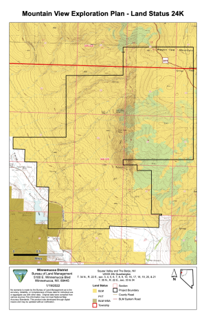
[[File:Mountain View Plan Land Status 24K.png|thumb|Mountain View Plan Land Status, 1:24k map. (BLM)]] | [[File:Mountain View Plan Land Status 24K.png|thumb|Mountain View Plan Land Status, 1:24k map. (BLM)]] | ||
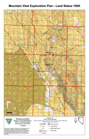
[[File:Mountain View Plan Land Status 100K.png|thumb|Mountain View Plan Land Status, 1:100k map. (BLM)]] | |||
=References= | =References= | ||
<references/> | <references/> | ||
Revision as of 04:02, 9 February 2022
In February 2022, the BLM announced that they were accepting pre-scoping comments for the Mountain View Exploration Project, located north east of Squaw Reservoir along Highway 34.[1]


References
- ↑ "Mountain View Exploration Project," February 7, 2022, BLM.