The Needle Rocks: Difference between revisions
Jump to navigation
Jump to search
Added References section |
m Text replacement - "http://geonames.usgs.gov/apex/f?p=gnispq:3:::NO::P3_FID:" to "https://edits.nationalmap.gov/apps/gaz-domestic/public/summary/" |
||
| Line 9: | Line 9: | ||
== Remote Resources == | == Remote Resources == | ||
* [ | * [https://edits.nationalmap.gov/apps/gaz-domestic/public/summary/847213 GNIS] | ||
** Alternative Name: "The Needles". Citation: "U.S. Department of the Interior, U.S. Geological Survey, 1:250,000-scale topographic maps; various edition dates. Represents new or changed names from published editions. Map name and year of publication follow (if known): Granite Range/1894" | ** Alternative Name: "The Needles". Citation: "U.S. Department of the Interior, U.S. Geological Survey, 1:250,000-scale topographic maps; various edition dates. Represents new or changed names from published editions. Map name and year of publication follow (if known): Granite Range/1894" | ||
Latest revision as of 20:33, 28 December 2021
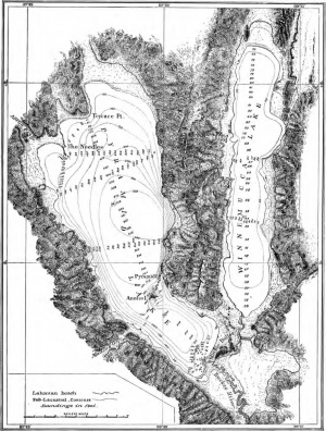
The Needle Rocks (aka The Needles]][1] are located at the north end of Pyramid Lake.
This location is inside the reservation is off limits due to graffiti.

References
- ↑ Israel Cook Russell, "Geological History of Lake Lahontan: A Quaternary Lake of Northwestern Nevada," 1885.
Remote Resources
- GNIS
- Alternative Name: "The Needles". Citation: "U.S. Department of the Interior, U.S. Geological Survey, 1:250,000-scale topographic maps; various edition dates. Represents new or changed names from published editions. Map name and year of publication follow (if known): Granite Range/1894"
See Also
- Needle Rock - located at the north end of Winnemucca Lake
- Wizards Beach
- Wizards Cove