Calico Hills: Difference between revisions
Jump to navigation
Jump to search
Image:Calico mountains.jpg |
No edit summary |
||
| Line 1: | Line 1: | ||
[[Image:Calico mountains.jpg|frame|right|Image:Calico mountains.jpg]] | [[Image:Calico mountains.jpg|frame|right|Image:Calico mountains.jpg]] | ||
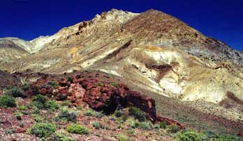
The Calico Mountains are located on the west-north-western edge of the Black Rock Desert Nevada, | |||
bounded by Hualapai Valley on the west, | |||
Donneley Peak on the northwest | |||
and the Playa on the east | |||
* http://www.calicomtns.net/about_the_calico_mtns.htm | * http://www.calicomtns.net/about_the_calico_mtns.htm | ||
| Line 12: | Line 18: | ||
* [http://en.wikipedia.org/wiki/Calico_mountains_(Nevada) http://en.wikipedia.org/wiki/Calico_mountains_(Nevada)] | * [http://en.wikipedia.org/wiki/Calico_mountains_(Nevada) http://en.wikipedia.org/wiki/Calico_mountains_(Nevada)] | ||
* http://130.166.124.2/nv_panorama_atlas/page17/files/page17-1014-full.html 130.166.124.2/nv_panorama_atlas/page17/files/page17-1014-full.html -- Nevada Atlas of Panoramic Aerial Images, Washoe County, Hualapai Flat | |||
Revision as of 03:02, 13 July 2007

The Calico Mountains are located on the west-north-western edge of the Black Rock Desert Nevada,
bounded by Hualapai Valley on the west, Donneley Peak on the northwest and the Playa on the east
- view from Steamboat hill of eastern side, taken from http://ian.kluft.com/blackrock/paragon-d2-200309/wed.html
- http://130.166.124.2/nv_panorama_atlas/page17/files/page17-1014-full.html 130.166.124.2/nv_panorama_atlas/page17/files/page17-1014-full.html -- Nevada Atlas of Panoramic Aerial Images, Washoe County, Hualapai Flat