Fresco: Difference between revisions
Jump to navigation
Jump to search
GNIS |
m Text replacement - "http://geonames.usgs.gov/apex/f?p=gnispq:3:::NO::P3_FID:" to "https://edits.nationalmap.gov/apps/gaz-domestic/public/summary/" |
||
| (One intermediate revision by the same user not shown) | |||
| Line 1: | Line 1: | ||
A station shown between [[Sand Pass]] and [[Sano]] in the WPRR 1910 timetable. | A station shown between [[Sand Pass]] and [[Sano]] in the WPRR 1910 timetable. | ||
Possibly renamed to [[Bryant]].<ref>[ | Possibly renamed to [[Bryant]].<ref>[https://edits.nationalmap.gov/apps/gaz-domestic/public/summary/846162 GNIS for Bryant], Citation: "County Base Map Series, Nevada Department of Transportation, historic (1930's). WA2/1937". Alternative Name: [[Fresco]]. Citation: "Clason's Map of Nevada. Denver: Clason Map Company, 1916, scale 1 in=16 miles."</ref> | ||
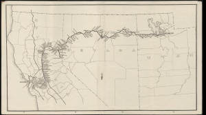
[[Image:Cscrm_000335_07_access3675x2040.jpg|right|thumb|WPRR 1910 Timetable showing Fresco.]] | [[Image:Cscrm_000335_07_access3675x2040.jpg|right|thumb|WPRR 1910 Timetable showing Fresco.]] | ||
| Line 7: | Line 7: | ||
== References == | == References == | ||
<references/> | <references/> | ||
[[Category:GNIS]] | |||
[[Category:Railroad sidings]] | |||
Latest revision as of 20:34, 28 December 2021
A station shown between Sand Pass and Sano in the WPRR 1910 timetable.
Possibly renamed to Bryant.[1]

References
- ↑ GNIS for Bryant, Citation: "County Base Map Series, Nevada Department of Transportation, historic (1930's). WA2/1937". Alternative Name: Fresco. Citation: "Clason's Map of Nevada. Denver: Clason Map Company, 1916, scale 1 in=16 miles."