Stormy Day Mine: Difference between revisions
Jump to navigation
Jump to search
Stormy Day is located at Limbo. |
|||
| (3 intermediate revisions by the same user not shown) | |||
| Line 1: | Line 1: | ||
The Stormy Day Mine (also known as the Old | The Stormy Day Mine (also known as the Old Thrasher Mine) was discovered in 1941 by [[Helen Thrasher]] and [[John James Thrasher]].<ref>Joseph V. Tingley, "[https://encrypted.google.com/books?id=LxpeTDkrYQMC&lpg=PA22&ots=kKUt1sj3Wf&dq=Thrasher%20mine%20limbo&pg=PA24#v=snippet&q=Thrasher&f=false R043: Mineral resources of the Kumiva Peak 30" by 60" quadrangle]," writes that another name for the Stormy Day Mine is The Old Thrasher Mine.</ref><ref> Clayton M. Rumsey, "[http://www.nbmg.unr.edu/dox/mla/mla_35-86.pdf Mineral Resources of the Mt Limbo Wilderness Study Area and Vicinity, Pershing County, Nevada]," 1986. Mentions Helen Thrasher and that the Thrasher Mine as being north of the Mt. [[Limbo]] area.</ref><ref>A. C. Johnson, "[http://www.nbmg.unr.edu/scans/2340/23400016.pdf Exploration, Development, and Costs of the Stormy Day Tungsten Mine, Pershing County, Nev.]," 1958. Recounts the discovery and ownership of the Stormy Day mine. Includes a diagram of the mine.</ref><ref>"[http://www.nbmg.unr.edu/scans/2340/23400017.pdf A Mineral Survey: Modoc Mines and Exploration, Hooker Mining District]," 1954.</ref><ref>Jay A. Carpenter, Byron S. Hardie, "[ftp://nas.library.unr.edu/keck/mining/SCANS/0160/01600016.pdf Notes on Washoe County Reconnaisance Trip]," 1946. UNR has photos from this trip.</ref> The Stormy Day Mine is located north of Mt. [[Limbo]] in the [[Selenite Range]]. | ||
The Stormy Day Mine is located at [https://geohack.toolforge.org/geohack.php?params=40.437385_N_119.29211_W 40.43738 -119.29211],<ref>"[https://mrdata.usgs.gov/mrds/show-mrds.php?dep_id=10047338 Stormy Day Mine]," USGS</ref> which is located at [[Limbo]]. | |||
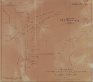
[[Image:TungstenPropertiesInTheGerlachArea1943.jpg|right|thumb|Tungsten Properties in the Gerlach Area (1943).<ref>M.R. Klepper, C.W. Chesterman, "[http://www.nbmg.unr.edu/scans/2340/23400014.pdf Tungsten Properties in the Gerlach Area]," Map, University of Nevada, Reno, KC-Special Collections, 1943.</ref> The location of the Stormy Day Mine is shown.]] | |||
== References== | == References== | ||
<references/> | |||
[[Category: Mines]] | [[Category: Mines]] | ||
[[Category: Pershing County]] | [[Category: Pershing County]] | ||
[[Category: Selenite Range]] | [[Category: Selenite Range]] | ||
Latest revision as of 01:43, 6 September 2022
The Stormy Day Mine (also known as the Old Thrasher Mine) was discovered in 1941 by Helen Thrasher and John James Thrasher.[1][2][3][4][5] The Stormy Day Mine is located north of Mt. Limbo in the Selenite Range.
The Stormy Day Mine is located at 40.43738 -119.29211,[6] which is located at Limbo.

References
- ↑ Joseph V. Tingley, "R043: Mineral resources of the Kumiva Peak 30" by 60" quadrangle," writes that another name for the Stormy Day Mine is The Old Thrasher Mine.
- ↑ Clayton M. Rumsey, "Mineral Resources of the Mt Limbo Wilderness Study Area and Vicinity, Pershing County, Nevada," 1986. Mentions Helen Thrasher and that the Thrasher Mine as being north of the Mt. Limbo area.
- ↑ A. C. Johnson, "Exploration, Development, and Costs of the Stormy Day Tungsten Mine, Pershing County, Nev.," 1958. Recounts the discovery and ownership of the Stormy Day mine. Includes a diagram of the mine.
- ↑ "A Mineral Survey: Modoc Mines and Exploration, Hooker Mining District," 1954.
- ↑ Jay A. Carpenter, Byron S. Hardie, "Notes on Washoe County Reconnaisance Trip," 1946. UNR has photos from this trip.
- ↑ "Stormy Day Mine," USGS
- ↑ M.R. Klepper, C.W. Chesterman, "Tungsten Properties in the Gerlach Area," Map, University of Nevada, Reno, KC-Special Collections, 1943.