Arcturus Mine: Difference between revisions
Jump to navigation
Jump to search
GNIS |
m Text replacement - "http://geonames.usgs.gov/apex/f?p=gnispq:3:::NO::P3_FID:" to "https://edits.nationalmap.gov/apps/gaz-domestic/public/summary/" |
||
| (9 intermediate revisions by the same user not shown) | |||
| Line 1: | Line 1: | ||
The Arcturus Mine is located in the [[Selenite Range]] between [[Frog (Garrett Ranch) Springs]] and [[Empire]]. | The Arcturus Mine is located in the [[Selenite Range]] between [[Frog (Garrett Ranch) Springs]] and [[Empire]]. | ||
The Arcturus Mine is a tungsten mine. | The Arcturus Mine is a tungsten mine in the [[Staggs Mining District]] or the [[Trego Mining District]]. | ||
In 1941, T.S. Dalton, Jack Dalton, and John Durkin discovered the mine. In 1943, it was leased to Hugh Dobbins, Edward Bottomly and Roy Hardy.<ref>"[ | In 1941, T.S. Dalton, Jack Dalton, and John Durkin discovered the mine. In 1943, it was leased to Hugh Dobbins, Edward Bottomly and Roy Hardy.<ref>"[https://collections.nbmg.unr.edu/?r=21772 Arcturus Property Report]," University of Nevada, Reno, KC-Special Collections.</ref> | ||
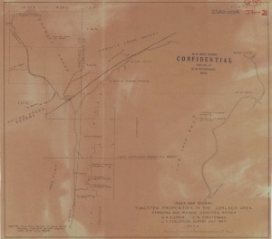
[[Image:TungstenPropertiesInTheGerlachArea1943.jpg|right|thumb|Tungsten Properties in the Gerlach Area (1943).<ref>M.R. Klepper, C.W. Chesterman, "[https://collections.nbmg.unr.edu/?r=10726 Tungsten Properties in the Gerlach Area]," Map, University of Nevada, Reno, KC-Special Collections, 1943.</ref> The location of the Arcturus Mine is shown.]] | |||
== References == | == References == | ||
<references/> | <references/> | ||
== | == External Links == | ||
* [[ | * [https://edits.nationalmap.gov/apps/gaz-domestic/public/summary/850364 GNIS] | ||
* M.R. Klepper, C.W. Chesterman, "[https://collections.nbmg.unr.edu/?r=2610 Geologic Sketch Map of the Arcturus Tungsten Mine]," University of Nevada, Reno, KC-Special Collections, 1943. | |||
* M.R. Klepper, C.W. Chesterman, "[https://collections.nbmg.unr.edu/?r=10726 Tungsten Properties in the Gerlach Area]," Map, University of Nevada, Reno, KC-Special Collections, 1943. | |||
* J. Quade, "[https://collections.nbmg.unr.edu/?r=21771 Arcturus Mine Property report]," University of Nevada, Reno, KC-Special Collections, 1985. | |||
[[Category:Mines]] | |||
[[Category:Selenite Range]] | |||
Latest revision as of 20:33, 28 December 2021
The Arcturus Mine is located in the Selenite Range between Frog (Garrett Ranch) Springs and Empire.
The Arcturus Mine is a tungsten mine in the Staggs Mining District or the Trego Mining District.
In 1941, T.S. Dalton, Jack Dalton, and John Durkin discovered the mine. In 1943, it was leased to Hugh Dobbins, Edward Bottomly and Roy Hardy.[1]

References
- ↑ "Arcturus Property Report," University of Nevada, Reno, KC-Special Collections.
- ↑ M.R. Klepper, C.W. Chesterman, "Tungsten Properties in the Gerlach Area," Map, University of Nevada, Reno, KC-Special Collections, 1943.
External Links
- GNIS
- M.R. Klepper, C.W. Chesterman, "Geologic Sketch Map of the Arcturus Tungsten Mine," University of Nevada, Reno, KC-Special Collections, 1943.
- M.R. Klepper, C.W. Chesterman, "Tungsten Properties in the Gerlach Area," Map, University of Nevada, Reno, KC-Special Collections, 1943.
- J. Quade, "Arcturus Mine Property report," University of Nevada, Reno, KC-Special Collections, 1985.