File:PyramidAndWinnemuccaLakesMapRussell1885.jpg: Difference between revisions
Jump to navigation
Jump to search
Link to Terrace Point. |
Added link to Rumsey. |
||
| Line 3: | Line 3: | ||
Source: Israel Cook Russell, "[https://archive.org/stream/geologicalhisto00russgoog Geological History of Lake Lahontan: A Quaternary Lake of Northwestern Nevada]," 1885. | Source: Israel Cook Russell, "[https://archive.org/stream/geologicalhisto00russgoog Geological History of Lake Lahontan: A Quaternary Lake of Northwestern Nevada]," 1885. | ||
* [[:File:PyramidAndWinnemuccaLakesMapRussell1885.tiff | tiff version]] | |||
* [http://www.davidrumsey.com/luna/servlet/s/h8d82t High resolution versions (David Rumsey)] | |||
Latest revision as of 02:30, 21 November 2016
Map of Pyramid and Winnumucca Lakes showing Astor Pass, Marble Buttes, The Needles, Terrace Pt.
Source: Israel Cook Russell, "Geological History of Lake Lahontan: A Quaternary Lake of Northwestern Nevada," 1885.
File history
Click on a date/time to view the file as it appeared at that time.
| Date/Time | Thumbnail | Dimensions | User | Comment | |
|---|---|---|---|---|---|
| current | 23:43, 20 November 2016 | 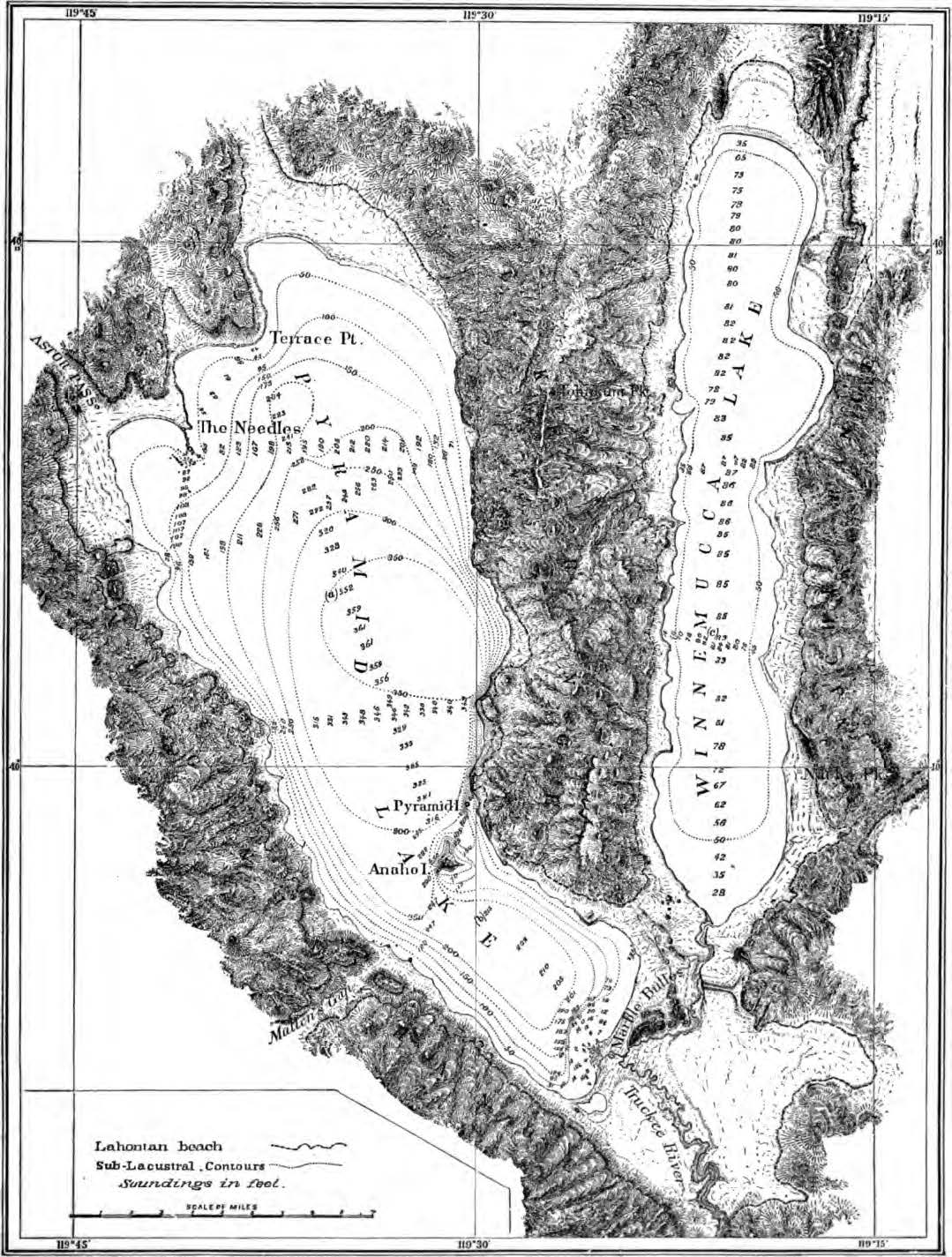 | 1,079 × 1,425 (268 KB) | Cxbrx (talk | contribs) | Map of Pyramid and Winnumucca Lakes showing Astor Pass, Marble Buttes, The Needles, Terrace Pt. Source: Israel Cook Russell, "[https://archive.org/stream/geologicalhisto00russgoog Geological History of Lake Lahontan: A Quaternary Lake of Northwest... |
You cannot overwrite this file.
File usage
The following 6 pages use this file: