Mountain View Exploration Project: Difference between revisions
Jump to navigation
Jump to search
Image |
→History: Link to Silver Bell |
||
| (4 intermediate revisions by the same user not shown) | |||
| Line 1: | Line 1: | ||
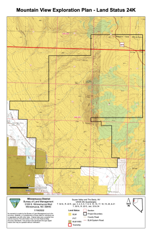
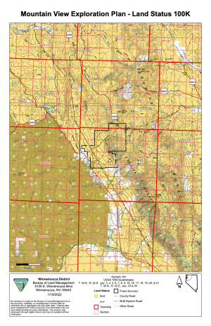
In February 2022, the BLM announced that they were accepting pre-scoping comments for the Mountain View Exploration Project, located north east of [[Squaw Reservoir]] along [[Highway 34]].<ref>"[https://eplanning.blm.gov/public_projects/2017396/200510614/20054147/250060330/Mountain%20View%20Expl%20DIP%20Letter.pdf Mountain View Exploration Project]," February 7, 2022, BLM.</ref> | In February 2022, the BLM announced that they were accepting pre-scoping comments for the Mountain View Exploration Project, located north east of [[Squaw Reservoir]] along [[Highway 34]].<ref>"[https://eplanning.blm.gov/public_projects/2017396/200510614/20054147/250060330/Mountain%20View%20Expl%20DIP%20Letter.pdf Mountain View Exploration Project]," February 7, 2022, BLM.</ref> | ||
[[File:Mountain View Plan Land Status 24K. | The [[Silver Bell Mine]] is part of the Mountain View Exploration Project. | ||
=History= | |||
In 1942, Giannelli describes the Mountain View mine and George Nash's nearby tungsten claim.<ref>"[http://ronhess.info/MD/scans/1360/13600002.pdf Report on Bureau of Mines Trip to Region About Gerlach]," Gianella, Vincent P., July 14-19, 1942.</ref> | |||
The Mountain View mine is described in 1985 as being in the [[Deephole Mining District]].<ref>"[https://www.google.com/books/edition/OF1985_03_A_mineral_inventory_of_the_Par/ZKIx9NjbSZ8C?hl=en&gbpv=1&dq=mountain+view+mine+gerlach&pg=PA28&printsec=frontcover OF1985-03: A mineral inventory of the Paradise-Denio -- and Sonoma-Gerlach Resource Areas, Winnemucca District, Nevada]," By H.F. Bonham, Jr., L.J. Garside, R.B. Jones, K.G. Papke, J.Quade, and J.V. Tingley, 1985.</ref> | |||
In 2015, Allied Nevada, the company that operated [[Hycroft Mine]] at the time reported that Vista acquired the property from Newmont Capital.<ref>"[https://web.archive.org/web/20150928183114/http://www.alliednevada.com/properties/mountain-view/ Mountain View]," Allied Nevada, retrieved September 28, 2015.</ref> | |||
[[File:Mountain View Plan Land Status 24K.png|thumb|Mountain View Plan Land Status, 1:24k map. (BLM)]] | |||
[[File:Mountain View Plan Land Status 100K.png|thumb|Mountain View Plan Land Status, 1:100k map. (BLM)]] | |||
=References= | =References= | ||
<references/> | <references/> | ||
Latest revision as of 04:14, 25 February 2022
In February 2022, the BLM announced that they were accepting pre-scoping comments for the Mountain View Exploration Project, located north east of Squaw Reservoir along Highway 34.[1]
The Silver Bell Mine is part of the Mountain View Exploration Project.
History
In 1942, Giannelli describes the Mountain View mine and George Nash's nearby tungsten claim.[2]
The Mountain View mine is described in 1985 as being in the Deephole Mining District.[3]
In 2015, Allied Nevada, the company that operated Hycroft Mine at the time reported that Vista acquired the property from Newmont Capital.[4]


References
- ↑ "Mountain View Exploration Project," February 7, 2022, BLM.
- ↑ "Report on Bureau of Mines Trip to Region About Gerlach," Gianella, Vincent P., July 14-19, 1942.
- ↑ "OF1985-03: A mineral inventory of the Paradise-Denio -- and Sonoma-Gerlach Resource Areas, Winnemucca District, Nevada," By H.F. Bonham, Jr., L.J. Garside, R.B. Jones, K.G. Papke, J.Quade, and J.V. Tingley, 1985.
- ↑ "Mountain View," Allied Nevada, retrieved September 28, 2015.