Crowbar Spring: Difference between revisions
Jump to navigation
Jump to search
Remove bar. |
m Text replacement - "http://geonames.usgs.gov/apex/f?p=gnispq:3:::NO::P3_FID:" to "https://edits.nationalmap.gov/apps/gaz-domestic/public/summary/" |
||
| (9 intermediate revisions by the same user not shown) | |||
| Line 1: | Line 1: | ||
Crowbar Spring is located south of [[Elephant Mountain]], east of the [[Black Rock Range]]. | Crowbar Spring is located south of [[Elephant Mountain]], east of the [[Black Rock Range]]. | ||
The 1946 Biennial Report of the Nevada State Engineer states that B. F. Porter Estate was using Crowbar Spring for stock watering.<ref>[https://books.google.com/books?id=0mkYAQAAIAAJ&q=%22Crowbar+Spring%22&dq=%22Crowbar+Spring%22&hl=en&sa=X&ved=0ahUKEwi_nuq4mezMAhVQ52MKHZ1gB_YQ6AEIHDAA 1946 Biennial Report of the Nevada State Engineer]," p. 110, 117, 1946.</ref> The estate was also using water from [[Chipmunk Spring]], [[Johnstone Spring]] and [[Whiterock Spring]]. | |||
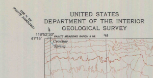
The name "Crowbar Spring" appears in the 1979 1:24,000 map by the same name.<ref>USGS, [http://ngmdb.usgs.gov/img4/ht_icons/Browse/NV/NV_Crowbar%20Spring_517358_1979_24000.jpg Crowbar Spring 1:24,000, 1979].</ref> | |||
[[File:CrowbarSpringUSGS1979.png|thumb|The portion of the 1979 1:24,000 USGS map that shows Crowbar Spring.]] | |||
== References == | == References == | ||
<references/> | |||
== Remote Resources == | == Remote Resources == | ||
* [https://www.flickr.com/photos/nevadadan/13987967791/ Photo | * [https://edits.nationalmap.gov/apps/gaz-domestic/public/summary/839882 GNIS] | ||
** Citation: "U.S. Geological Survey. Geographic Names Phase I data compilation (1976-1981). 31-Dec-1981. Primarily from U.S. Geological Survey 1:24,000-scale topographic maps (or 1:25K, Puerto Rico 1:20K) and from U.S. Board on Geographic Names files. In some instances, from 1:62,500 scale or 1:250,000 scale maps." | |||
* [https://www.flickr.com/photos/nevadadan/13987967791/ Photo] (Flickr) | |||
[[Category:GNIS]] | |||
[[Category:Springs]] | [[Category:Springs]] | ||
[[Category:USGS Quads]] | |||
Latest revision as of 20:34, 28 December 2021
Crowbar Spring is located south of Elephant Mountain, east of the Black Rock Range.
The 1946 Biennial Report of the Nevada State Engineer states that B. F. Porter Estate was using Crowbar Spring for stock watering.[1] The estate was also using water from Chipmunk Spring, Johnstone Spring and Whiterock Spring.
The name "Crowbar Spring" appears in the 1979 1:24,000 map by the same name.[2]

References
- ↑ 1946 Biennial Report of the Nevada State Engineer," p. 110, 117, 1946.
- ↑ USGS, Crowbar Spring 1:24,000, 1979.
Remote Resources
- GNIS
- Citation: "U.S. Geological Survey. Geographic Names Phase I data compilation (1976-1981). 31-Dec-1981. Primarily from U.S. Geological Survey 1:24,000-scale topographic maps (or 1:25K, Puerto Rico 1:20K) and from U.S. Board on Geographic Names files. In some instances, from 1:62,500 scale or 1:250,000 scale maps."
- Photo (Flickr)