File:USGS Historical Photographs - (surveying the) Desert Area near Jungo Nevada 1931.jpg
Jump to navigation
Jump to search

Size of this preview: 800 × 433 pixels. Other resolution: 1,217 × 659 pixels.
Original file (1,217 × 659 pixels, file size: 65 KB, MIME type: image/jpeg)
http://online.wr.usgs.gov/outreach/historicPhotos/enlarged/jungo_nevada.html
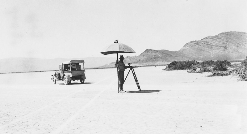
Outreach in the Western Region
Historical Photographs: Desert Area near Jungo, Nevada
1931
Mapping the north half of the Lovelock 1° quadrangle in the desert area near Jungo, Nevada. August.
This photo is a work of the US Government and thus in the public domain.
File history
Click on a date/time to view the file as it appeared at that time.
| Date/Time | Thumbnail | Dimensions | User | Comment | |
|---|---|---|---|---|---|
| current | 07:58, 7 June 2007 | | 1,217 × 659 (65 KB) | Bc (talk | contribs) | http://online.wr.usgs.gov/outreach/historicPhotos/enlarged/jungo_nevada.html Outreach in the Western Region Historical Photographs: Desert Area near Jungo, Nevada 1931 Mapping the north half of the Lovelock 1° quadrangle in the desert area near Jun |
You cannot overwrite this file.
File usage
The following page uses this file:
_Desert_Area_near_Jungo_Nevada_1931.jpg&oldid=6123)