File:TregoMap1913.png
Jump to navigation
Jump to search
Size of this preview: 718 × 599 pixels. Other resolution: 913 × 762 pixels.
Original file (913 × 762 pixels, file size: 684 KB, MIME type: image/png)
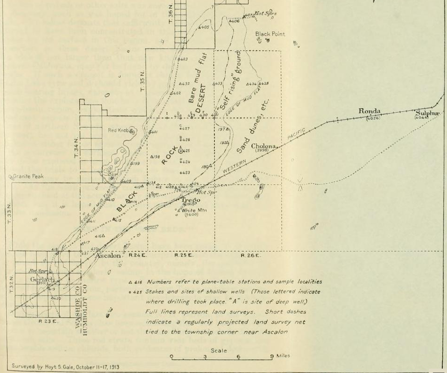
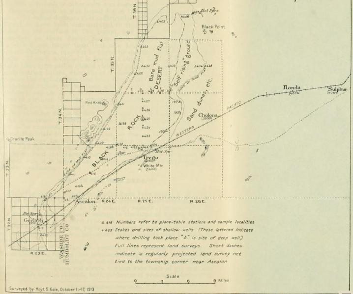
Source: Mineral Resources of the United States, 1914--Part II--Nonmetals", plate 1, facing page 16. Discussion of drilling in the center of the playa for Potash: "The site selected for the boring is in the center of the Black Rock Desert, about 4 J miles due north of the flag station Trego, on the Western Pacific Railway, and 18 miles northeast of Gerlach, a division point on the railroad." Includes a map that names Old Razorback Mountain as "White Mtn" and Steamboat Mountain as "Red Knob".
File history
Click on a date/time to view the file as it appeared at that time.
| Date/Time | Thumbnail | Dimensions | User | Comment | |
|---|---|---|---|---|---|
| current | 06:40, 24 November 2014 | | 913 × 762 (684 KB) | Cxbrx (talk | contribs) | Source: [https://archive.org/details/mineralresources142unit Mineral Resources of the United States, 1914--Part II--Nonmetals"] Discussion of drilling in the center of the playa for Potash: "The site selected for the boring is in the center of the Bla... |
You cannot overwrite this file.