File:Cscrm 000335 07 access3675x2040.jpg
Jump to navigation
Jump to search

Size of this preview: 800 × 444 pixels. Other resolution: 3,675 × 2,040 pixels.
Original file (3,675 × 2,040 pixels, file size: 1.46 MB, MIME type: image/jpeg)
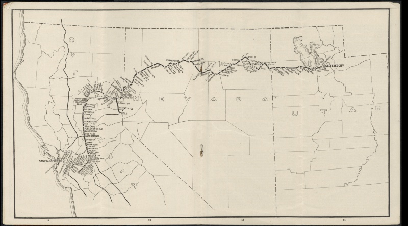
Map of the route of the Western Pacific Railroad from the 1910 first public time table.
Included are Puna, Flanigan, " Keppler", Sand Pass, Fresco, Sano, Reynard, Bronte, Phil, Gerlach, Ascalon, Trego, Cholona, Ronda, Sulphur, Antelope, Jungo.
Original source: https://ia801504.us.archive.org/23/items/cscrm_000335/cscrm_000335_07_access.jpg
File history
Click on a date/time to view the file as it appeared at that time.
| Date/Time | Thumbnail | Dimensions | User | Comment | |
|---|---|---|---|---|---|
| current | 06:24, 10 September 2015 | | 3,675 × 2,040 (1.46 MB) | Cxbrx (talk | contribs) | Map of the route of the Western Pacific from the 1910 first public time table. Included are Puna, Flannigan, Keppler, Sand Pass, Fresco, Sano, Reynard, Bronte, Phil, Gerlach, Ascalon, Trego, Cholona, Ronda, Sulphur, Antelope, Jungo. Original source:... |
You cannot overwrite this file.
File usage
The following 17 pages use this file: